

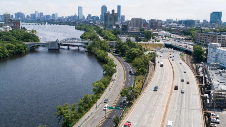
The design places I-90, Soldier's Field Road, and rail tracks between BU and the Charles River.
After years of community discussions and multiple proposed designs, the state says it’s moving forward with grounding I-90 in Allston along Boston University and the Charles River.
At a Wednesday meeting, MassDOT officials shared plans for the $1.7 billion project that will ground a section known as the “throat” and straighten out the curve in the highway near Allston, build a new rail station on the Worcester/Framingham line, and open up 100 acres of mostly Harvard-owned land for development, while preserving Soldier’s Field Road. State Highway Administration Jonathan Gulliver confirmed that the state will not be increasing tolls to fund the project, instead seeking alternative funding sources.
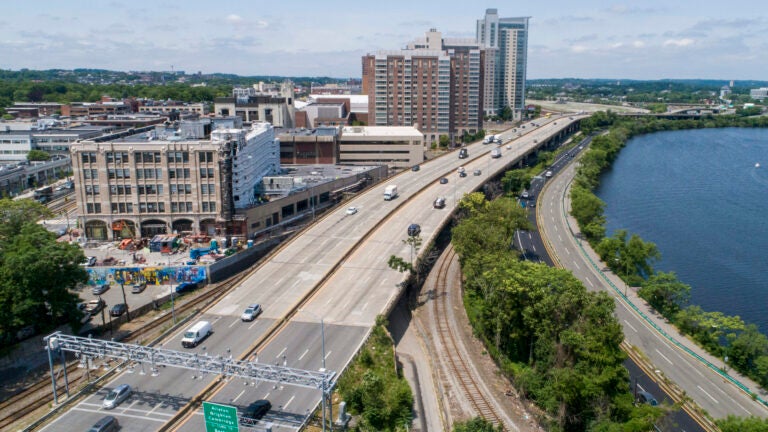
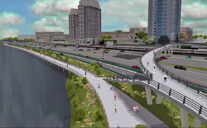
The project squeezes eight lanes of highway, four lanes of Soldier’s Field Road, and four rail tracks at ground level, and pushes the pedestrian and bike path out over the river, to be built on pilings. Pedestrians will also be able to access the river from Boston University on a new bridge.
The design resolves years of negotiations over how to manage the project area. It all started because the viaduct is over 60 years old and sorely needs repairs, but stakeholders have disagreed over how to redesign the limited space to serve all transit needs, with many community members pushing for a ground — or “at-grade” — level design.
A Better City, which has long supported this project design, touted the state’s current proposal and called it a “critical step toward improving the mobility, environmental justice, and economic competitiveness of our region.”
“Once completed, this project will not only help transform the future of transportation in the Commonwealth, but also reconnect our urban neighborhoods to the Charles River Basin,” ABC President and CEO Rick Dimino said in a statement to Boston.com. “Governor [Charlie] Baker, Secretary [Jamey] Tesler, and Administrator Gulliver have listened to the broad and diverse coalition of stakeholders, the City of Boston, and cities and towns in Central Massachusetts that have rallied behind the All At-Grade design for its potential to dramatically improve livability, connectivity, and sustainability in the region and reduce costs to the Commonwealth over the long term.”
Gulliver said Wednesday that this is just the beginning of a long permitting process that will involve coordination between multiple agencies. Permitting, and the rest of the design process, will take about two years, and construction is estimated to take another seven.
Since it’s taken so long to reach this point, and the existing viaduct still needs repairs, the state is seeking $75 million in funding to ensure the viaduct’s safety.
“MassDOT is ensuring the near-term safety of the viaduct and reducing the risk of future emergency repairs that would impact rail and road users,” the department said in a statement to The Boston Globe.
State Rep. Kevin Honan (D – 17th Suffolk) thanked MassDOT officials for listening to and working with the community to develop the ground-level design, and committed to helping find funding.
“It allows so much more access to the Charles River and the Paul Dudley White walkway, freeing up this extraordinary resource to our city,” he said. “We look forward to helping you in any way we can.”
MassDOT will next discuss the project at an Oct. 21 virtual meeting.
Newsletter Signup
Stay up to date on all the latest news from Boston.com
"design" - Google News
September 30, 2021 at 09:39AM
https://ift.tt/3igx460
State moving forward with ground-level design for Allston Mass. Pike project - Boston.com
"design" - Google News
https://ift.tt/2tAY9dw
https://ift.tt/2zaSFZM
Bagikan Berita Ini


0 Response to "State moving forward with ground-level design for Allston Mass. Pike project - Boston.com"
Post a Comment